
An Cnoc Bui [Knockbwee]
Good walks are even better shared.
Overview
An Cnoc Bui [Knockbwee]
Nestled in the charming landscapes of the Neagh and Mourne region, An Cnoc Bui, or Knockbwee, beckons hikers with its rolling green hills and stunning panoramic views. Standing at 606 meters, this Hewitt is a delightful challenge for those wanting to explore the less-trodden paths of Northern Ireland.
Geology
An Cnoc Bui is a gem formed from sedimentary rocks, including sandstone and shale. Its gentle slopes and impressive cliffs have been crafted by the artistry of glaciers from the last Ice Age. As you ascend, keep an eye out for interesting rock formations that tell a tale of ancient geological processes.
Routes
One of the most popular routes is the Knockbwee Circuit. This 10.5-kilometer loop starts from the quaint township of Martray, allowing hikers to meander through lush green fields and rocky outcrops, making it a moderate hike perfect for an invigorating day out. Expect it to take around 3.5 hours, depending on your pace and how many stops you make for photographs (everyone loves a good summit selfie!).
Summit Features
At the summit, you’re greeted by a grand cairn, standing proud against the skyline. This stone marker isn’t just for show; it’s a fantastic vantage point for enjoying the exhilarating sense of accomplishment and the stunning views that stretch out before you.
Terrain Type
Be prepared for grassy trails intertwined with rocky patches, which may become boggy in wetter weather. Good footwear is a must unless you fancy carrying half the hill's mud back with you!
Views
Once you’ve conquered the ascent, the views from An Cnoc Bui will take your breath away. Look towards Lough Neagh to the north for a shimmering expanse of water, while the magnificent peaks of the Mourne Mountains rise toward the southeast. For those who love a good sunset, the early autumn months will reward you with a sunset spectacle that’s second to none.
Hazards
Remember, it’s not all sunshine and rainbows. The terrain can be slippery after a rain shower, and boggy patches are hidden traps that can turn your hike into a mud bath. Stay vigilant and check local weather forecasts before heading out to ensure you’re suitably prepared for whatever Mother Nature has in store.
Access
To reach the starting point at Martray, parking is available for a small number of cars—arrive early, as it fills up quicker than a kettle on a winter's day. Public transport options are sparse, but Dungannon, the nearest town, offers sufficient amenities for a pre-hike breakfast or a post-hike pint.
Facilities
Dotted around Dungannon are a variety of cafes and pubs. It’s the perfect excuse to indulge in a slice of cake or a well-deserved locally brewed ale after conquering An Cnoc Bui!
History
An Cnoc Bui's name speaks to its vibrant foliage, with ‘bui’ meaning yellow in Irish, likely reflecting the hill's golden hues during certain times of the year. The mountain is also steeped in legend, with tales of ancient settlers and mythical creatures adding a sprinkle of enchantment to your hiking adventure.
So, lace up your boots, grab your walking stick, and hit the trails of An Cnoc Bui for a delightful day out in the great outdoors!
Explore routes near An Cnoc Bui [Knockbwee]
Public walks starting within 80 km of this hill. Nearby does not mean a route reaches the summit; check its map and access before setting out.
No public routes are currently listed within 80 km of An Cnoc Bui [Knockbwee] on Walkmates. This does not mean there are no paths here. Explore the map and check local access information before planning a walk.
Route planning notes
These notes describe possible approaches, not verified navigable routes or permission to cross land. Check current paths, local access rules and conditions before setting out.
Knockbwee Circuit
A picturesque circuit starting from the small township of Martray, this route takes you up and around An Cnoc Bui, providing various vistas of the surrounding valleys.
Make a day of it, together
Find someone to share the walk with, or organise a day out along a route you like.
Hill facts and local notes
Classifications
Elevation
461m
1,512 ft
Prominence
108m
Coordinates
51.9558, -9.2750
W124789
OS Map
79
At the Summit
The summit of An Cnoc Bui features a prominent cairn, with a stone marker that offers excellent photo opportunities and a chance to catch your breath after the climb.
Terrain & Geology
An Cnoc Bui is primarily composed of sedimentary rocks, including sandstone and shale, typical of the geological formations found in the region. The landscape features gentle slopes and dramatic cliffs, shaped by glacial activity during the last Ice Age.
Views & Scenery
From the summit, hikers are treated to breathtaking views of Lough Neagh to the north, the peaks of the Mourne Mountains to the southeast, and the rolling hills of County Tyrone to the west.
History & Heritage
Name Origin
An Cnoc Bui translates to 'the yellow hill' in Irish, likely referencing the grass that blooms golden during certain seasons.
Historical Significance
The mountain is steeped in local folklore, with stories of ancient settlements in the hills and tales of mysterious creatures that roam the nearby forests.
Getting There & Facilities
Check current local access restrictions, parking rules and transport timetables before travelling. These notes do not confirm public access to the summit.
Parking
Parking is available at Martray, where a small designated area can hold about 5-6 cars. Arrive early to secure a spot!
Public Transport
Public transport is limited; however, the nearest bus stop is in the village of Dungannon, about 15 kilometers away from the starting point.
Nearby Facilities
While there are no facilities directly on the mountain, Dungannon offers several cafes, pubs, and toilet facilities, perfect for a post-hike treat.
Safety Information
Known Hazards
- Watch for slippery rocks, particularly after rain, and be cautious of boggy areas that can be treacherous. Weather conditions can change rapidly, so always be prepared.
General Safety Tips
- Check weather conditions before setting out
- Carry appropriate clothing and equipment
- Let someone know your planned route
- Take a map, compass, and GPS device
- Carry emergency supplies: food, water, first aid kit, torch
Hills
Some common questions about the hills answered
Are there group walks up An Cnoc Bui [Knockbwee]?
Many walkers use Walkmates to join or organise walks with others. You can check for group walks around An Cnoc Bui [Knockbwee] through the maps
Are there other walkers around An Cnoc Bui [Knockbwee]?
Activity varies by location and time, but Walkmates lets you see whether others have shared walks or shown interest in this area. Find other people through the walking friends search walking friends for An Cnoc Bui [Knockbwee] search or of course create your own walk for An Cnoc Bui [Knockbwee]
Can I organise a walk to An Cnoc Bui [Knockbwee]?
Yes. If there aren’t any walks listed already, you can create a walk and make it available for others to join.
If you're signed up to Walkmates, you can create a walk to An Cnoc Bui [Knockbwee].
How do I find a walk up this hill?
There are often multiple ways to walk this hill, depending on experience and route preference. Walkmates helps you explore walks and routes that others have shared.
Can I suggest a new route up An Cnoc Bui [Knockbwee]?
Yes. You can suggest or create routes to share with others. Walkmates focuses on the social side of walking, so routes are used to help people organise walks and explore areas together, rather than as detailed navigation tools or route libraries.
Other uses really appreciate knowledgeable walkers sharing their routes. Share your favourite route to An Cnoc Bui [Knockbwee] here
The is an error or something incorrect about this hill. How do I let you know?
We always strive to keep the information on Walkmates as accurate as possible. If you find an error, please let us know through the contact form and we'll aim to correct it as quickly as possible
Community Discussion
Comments
Location
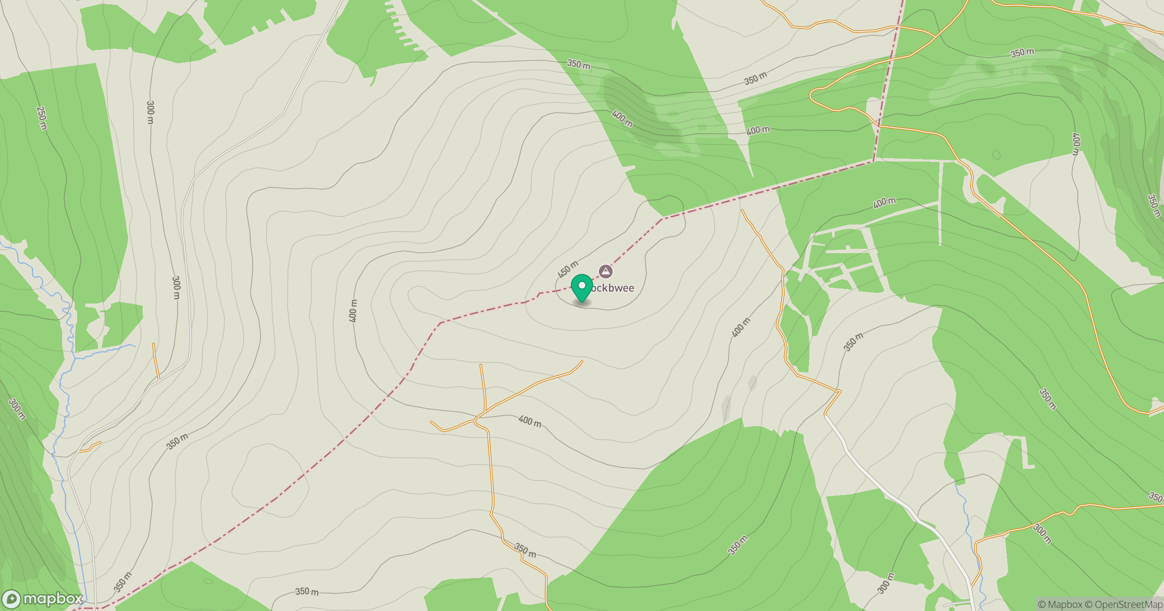
Grid reference: W124789
View on OpenStreetMapOpens a map in a new tab, centred on the hill.
Hills within 30 km
Straight-line distance, not a walking route or confirmation of access.
No comments yet. Be the first.